

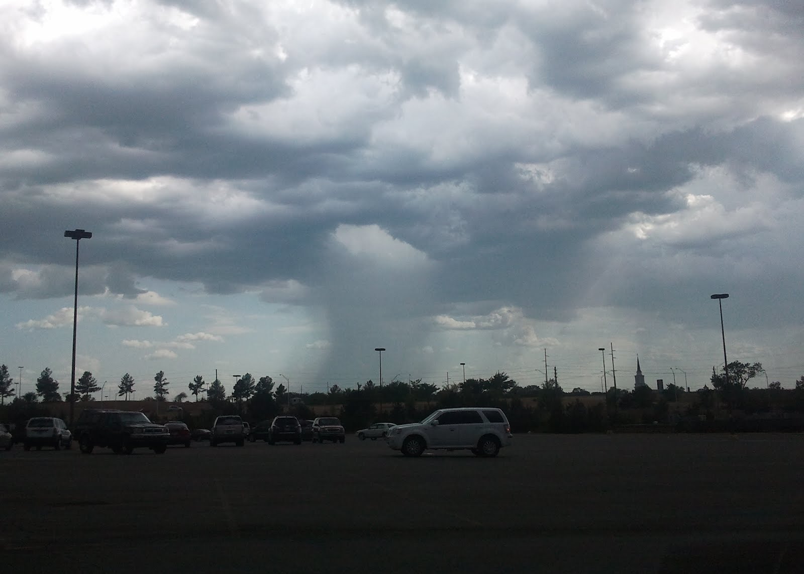
 (ABOVE: KJRH viewers Nik Stophel (Highway 169 looking toward Bixby) and Michael Wheeler (Bartlesville) took pics of microbursts and their downpours. Microbursts have a sharp contrast from intense downpour to calm surroundings.)
A downburst is simply a highly concentrated strong wind blowing straight down (a down-burst of wind) from a storm. Only a few square miles are impacted.
The term microburst is used to describe a tiny downburst. A microburst creates intense damaging wind over a small 1-2 square mile area.
Two microbursts hit Tulsa and the Bixby areas in recent weeks. Other downburst/microburst destruction was reported in Washington and Nowata counties.
Microbursts are a problem for meteorologists as the exact moment a storm decides to "burst" can't exactly be predicted until downward movement is noted within the precipitation core. By then the downburst is already underway.
Downbursts can occur when a heathly thunderstorm inhales hot, dry air from outside of the cloud. This dry air evaporates the rain creating a huge pocket of cooler air within the storm.
As cooler air is heavier, this cold chunk of air falls straight down. In extreme cases the wind can reach over 100mph! Hurricane-looking conditions result for up to 10 minutes.
Different types of downbursts are also possible with "wet" and "dry" microbursts being identified.
Trees don't fare well in microbursts as the limbs are forced toward the ground.
Here are the conditions that I look for when watching for downbursts/microbursts:
- High temperatures with fairly dry air: 95°+ air temperatures with a dew point temperature of 65° or lower.
- If temperatures are closer to 100° with a 60° dew point, then microburst potential is greatly enhanced. (A difference of 35-40° between the temperature and dew point is ideal.)
- Light upper level wind (such as in July and August).
- Storms which build and develop "straight up" are microburst candidates.
- Interesting note: Drought years (like 2012) are more prone to microbursts due to the larger difference between the temperature and dew point temperature.
Hope this info helps... Thanks for reading! George


