(ABOVE: The SPC's morning forecast shows a bullseye tornado target in southern KS and central and eastern OK.)
The storm chase of May 24, 2011 was a bit unnerving as strong tornadoes were forecast in our region. The SPC issued a rare "High Risk" for severe weather from Wichita to west of OKC to Tulsa. Due to the expected low storm cloud bases, the tornadoes would likely be hard to see. The chase would prove difficult.
(BELOW: From our chase two days before, a small tornado near Twin Oaks, OK. The tornadoes expected on 5/22 would be much larger.)

My assignment was to drive to the middle of the High Risk area, then chase the storms back toward Tulsa and our viewing area. (no, KJRH doesn't force me to do this! But I'm the first to volunteer for it.) Enid was the preliminary target.
My chase partner (Wifey) and I left Tulsa near 1pm. Storms were beginning to fire in western and central Oklahoma. A Tornado Watch was issued. We drove west on Highway 412 in StormChaser 2 (SC2).
 (ABOVE: Bucky and our other doggies have a storm shelter in case of bad storms. Bucky approves!)
 We encountered a computer problem in SC2 near Hallett and were delayed about 20 minutes. We got going again after I fixed the computer and live video feed.
Along with reporting live via Bluetooth, I've gotta: answer and ignore two dozen phone calls and texts, look at weather maps, road maps, GPS, radar data, figure out where to drive now and future, while taking pics and video when possible, scanning the storm with my eyes, and grabbing a handful of Runts candy for dinner, I have to fix whatever computer problems come up. And drive in severe thunderstorms-- storm chasing sound fun yet?! Oh, and watch out for falling debris too! More on that shortly...
 (ABOVE: The blue cross-hairs shows our location. We decide to abandon heading west toward Enid as the storms toward OKC have better potential to become dominant)
Storms fired from west of OKC to west of Enid. The storms near Enid were behind the main line, and were having difficulty achieving their potential. They were unlikely to "turn right" and head due east, so we changed our plan and targeted central Oklahoma.
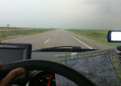 (ABOVE: My view driving SC2. The sky appeared the same shade of gray.)
We dropped south on I-35 toward Guthrie. The storms immediately to our west didn't look worthy of chasing, so we pulled off I-35 to refuel. I also have to plan ahead on gas as we have short cruising range.
Tornado Warnings 100 miles away. Tornadoes touched down west of OKC. We heard reports of damage in the western suburbs of OKC. We would chase whatever evolved from it. Dan Threlkeld called. He wanted us to patrol this area to cover the storms as they moved toward our viewing area.
Storms with Tornado Warnings proceeded through and north of OKC. We repositioned ourselves south of Stillwater to intercept. We abandoned I-35 in case of traffic problems due to the Warnings.
 (ABOVE: We drive south. We are positioning ourselves to intercept the northern Tornado Warning. This storms looks larger than the Tornado Warned storm in the middle.)
We drove parallel to I-35 heading south on dirt and gravel roads toward Langston. On radar, a massive looking wrapped up tornado signature appeared to head toward Guthrie. We heard reports of a tornado "on the ground".
We turned west from Langston and nervously drove on Highway 33 toward Guthrie searching for the tornado. Little conversation in the car as we scanned the skies.
A huge storm was obviously in front of us. The gray sky appeared a solid color, and it was hiding subtle features which could indicate where the tornado was hiding. Dan Lockhoff back at KJRH messaged us saying that a tornado was highly likely in Guthrie. We were three miles away. I switched our radar data feed from rain to velocity, and the tornado signature was obvious.
 (ABOVE: This is wind velocity mode. The tornado would be where green meets white and red. We very cautiously drive westward.)
The sky darkened as we approached Guthrie from the east. Tons of lightning in front of us. Several police cars and storm spotters were the only cars on the road. The clouds were dark and spooky; lightning nearing. On radar, the tornado should appear in front of us soon.
Wifey and I couldn't see it, and we were getting too close. We turned around one mile from Guthrie and drove back east. We didn't want to get caught in town if a tornado suddenly emerged in front of us. We drove up a hill for better visibility. With the SW to NE movement, the tornado should pass just to our north.
We pulled off 33. A dark feature appeared just north of the highway. I recognized a crisp wall cloud through the rain. A black cloud then extended to the ground-- this was it. A large, dark tornado was one mile away. It didn't look like a classic "Wizard of Oz" tornado, instead it was a dark cloud attached to the ground. Rain being pulled into the circulation meant the tornado was hard to see.
 (ABOVE: Tornado. The crispness of the mesocyclone isn't obvious. We are looking just northeast of Guthrie.)
The wind suddenly and rapidly increased from the west-- this was the rain and wind wrapping around the circulation. The rain overtook SC2 and our visibility was quickly dropping to zero. We accelerated to safety driving east. When safe, we pulled off a few miles later to capture more video. The tornado, now between Guthrie and Stillwater looked more like a cloud on the ground. The rapid churning could only be seen up close, and this wasn't a storm that we wanted to see that close!
The outer rain bands and wind caught up to us again. Stuff started falling from the sky. Roof tiles fluttered past! A tree branch from somewhere soared over the road. The tornado obviously had hit homes somewhere near Guthrie, and occasional pieces of storm damage fell from the sky. I vividly remember a black, asphalt roof tile flying past the windshield. We were safe from the tornado, but the strong wind, falling chunks of whatever weren't fun to drive in.
Lightning. It was intense as it gets.
Frequent, powerful bolts struck every few seconds. We saw a tree get hit. The gas station we briefly pulled into had its sign blasted by lightning. Blinding purple flash, and the thunder sounded like an explosion.
 (ABOVE: Highway 177 toward Stillwater. We can't tell from our view, but this tornado remains "on the ground".)
Rain bands rocked our vehicle. We zoomed east and decided to leave the storm especially as the rain began to completely choke off the inflow wind. And we couldn't see the tornado anymore.
The tornado died before moving into Stillwater, and the tornado threat was over for now. The storm would later produce an EF2 rated tornado in Osage county.
We headed east and south as our attention turned to Tulsa. The storms were somewhat evolving into a line. The storms were changing structure as visually they appeared outflow dominant. We followed the storm line for about an hour into Lincoln and Creek counties as they moved toward Tulsa.
We then decided to leave these storms as "only" straight line wind and hail were the immediate threat. Quarter-size hail pelted us near Bristow. We shrugged it off and kept driving. At this point I visually knew for the first time that Tulsa county was going to live. The ugly looking clouds were more scary-looking than tornado-like.
 (ABOVE: Old Highway 75 near Sapulpa. The leading edge of the cloud indicates cool, but strong wind pushing out from the storm. Tulsa would be fine.)
 The smooth bottoms and unusual looking attachments indicated cold air blowing out from the storms. Storms which produce tornadoes (except for gustnadoes) suck in air. Sure, straight line winds can cause damage, but a big tornado wasn't going to remove Tulsa. Our doggies back home would be fine. :) Back at KJRH, Dan, Andy and Julie warned Tulsans of the wind.
Another cluster of storms was moving into our viewing area just south of Tulsa. These storms produced Tornado Warnings and damage earlier near Chickasha and Shawnee-- if locations south of Tulsa were going to have tornado problems, this would be it.
We drove through Creek county to get south of Tulsa. I took county roads and Old Highway 75 to avoid traffic in Sapulpa. SC2 was drinking gasoline with my spirited driving too. The needle on the gas gauge was plunging quickly.
A Tornado Warning was issued for Okmulgee county. We drove to Kiefer, then east to Glenpool then south on Highway 75. A gas station I planned to stop at south of Glenpool was closed.
Stupid trees were blocking our view to the southwest. While doing a phoner on live TV, I said something like "Hey Andy (Wallace). I love our beautiful trees here in Oklahoma, but I don't like them much now as they are really getting in the way of me trying to see the storm!" He chuckled. A little humor, I guess during a stressful situation.
We kept zooming down 75 looking for a clearing. What was beyond the trees? Our radar velocity feed indicated a not-well-developed circulation approaching Beggs. We exited Highway 16 toward Beggs. I found a small clearing and pulled over.
Finally able to see the storms, the supercell had good structure and a small, not-ready-to-tornado-yet wall cloud. "We have wall cloud, but no tornado," I told our viewers on live TV.
The storm was sucking in air. We were east of the storm, and a steady east wind was flowing into the storm. Tornado potential was growing.
My low fuel light came on. I had driven 201 miles since refuelling. A "normal" Honda Element should return about 25mpg on the highway. With our weather stuff nailed to the top of our heavily modified Honda, heavy on board computers and electricity usage, we averaged 16.6mpg for the chase. When your gas tank only holds 13 gallons, uhm, yeah, you do the math!
With no gas stations anywhere for miles, we were forced to briefly leave the chase. I zoomed south to Okmulgee to refuel. At the Shell station, lots of people swarmed our vehicle with weather questions. People took pictures of us. We quickly told them that Okmulgee was fine. I was in hurry, so I put in just 6 gallons and left abruptly.
Back to the chase. Our velocity data indicated the circulation crossing Highway 75 near Highway 16. We were 10 minutes behind it now. We exited on 16 east, and we saw no signs of tornado damage. I relayed this info to our viewers.
(BELOW: I don't recommend this! We drive due east through the edge of the circulation.)

We drove in the rain, east on 16 while the strongest part of the storm churned over rural Okmulgee county. The storm was intensifying on radar as it approached Haskell. The storm was intensifying also from our view. A tornado could develop at anytime a few miles to the left of my driver's side window.
A very strong NW wind tried to blow us around. Two hands on the steering wheel. Very heavy rain was falling.
I did another live phoner. I warned of the increasing inflow, and that a tornado could form near Haskell. Andy and Dan called my driving "performing a surgical manuever" as I knew exactly where we were in relation to the possible tornado toward my left.
This mesocyclone wind was circulating counterclockwise. Our driving goal was to navigate around the wind, around the circulation, and we'll stay out of the tornado. I felt the west wind push us. We would be fine in our location.
 (ABOVE: Purple dot shows our position. We choose to not pursue the tornado northward as we might not see it near sunset.)
As we got south and east of the storm, a very, very strong south inflow crosswind made driving more adventurous. The storm was sucking in tons of air, doing everything visually and wind-wise to produce a tornado, possibly a large tornado. Chief Meteorologist Dan Threlkeld warned viewers of a tornado approaching Haskell. Wifey switched the radar feed to rain mode-- the display looked like a "tornado on the ground" near Haskell.
We got east and ahead of the storm, the proceeded north with caution toward the tornado. Was now nearing 9pm, getting too hard to see thirty minutes after sunset. If a tornado was on the ground it would cross in front of us. We couldn't see anymore.
Would require vigilant driving heading toward Haskell as we could be driving into the debris path.
 (ABOVE: Oak tree completely blocks our path. Would find a different route into Haskell.)
South of Haskell we screeched to a halt. A large oak tree covered the road, obvious storm damage. We couldn't drive around it, so we doubled back for another route into town. After dark and with no visibility, we decided to end our chase and look for possible damage. We have a large First Aid kit in SC2 just in case...
...
We arrived in Haskell minutes after the storm passed. Debris was scattered, a tornado has just torn through town. A few roofs were gone, signs destroyed, trees down, metal pealed away and electricity was out. I felt somewhat relieved as it wasn't a huge, "ground scrubber" type tornado. No injuries, no one died. The town would be ok.
I tried to help where I could before the news. I drove SC2 into a neighborhood so the headlights could shine and illuminate a tree which was being chainsawed to clear the street. A firefighter asked me to tell our viewers to "stay out" of Haskell. Non-residents were driving through interfering with the searching and clean up.
 (ABOVE: Several trailers were blown over in Haskell.)
I did live reports from Haskell for the 10pm news. I stood next to a pile of roof debris and described what damage I could see as looking like an EF1 tornado. The NWS later surveyed the damage and assigned it an EF2 rating. The tornado was on the ground for 8 miles, and I'm guessing the worst damage was northeast of Haskell. The tornado crossed the Arkansas River and dissipated near Red Bird. Another tornado from the storm created more damage in the Wagoner area.
 (ABOVE and BELOW. Wifey took these pics of 2NEWS reporter Jason Grubbs and me. In the bottom pic, I am the cameraman for Jason's live shot. I'm Skyping with a Ipad.)
...
Tulsa and our viewing area survived the storms. On what could have been a really bad storm day for eastern Oklahoma, most of us did just fine. On a scale to 10, the level of difficulty for this chase was about a 10.
We helped get the word out. I love my job and its responsibility. I live my dream every day working as a meteorologist in Oklahoma.
That's the story of my work day for May 24, 2011. Thanks for reading. George
(BELOW: This pic made me smile for some reason. Probably because everyone pitched in. A tow truck is used to haul away a fallen tree along the city streets of Haskell.)


 (ABOVE: from 1949. Tom Windham, my uncle, sketched this image of my Grandfather with lead! My Aunt Thelma Windham Emory gave this to me.)